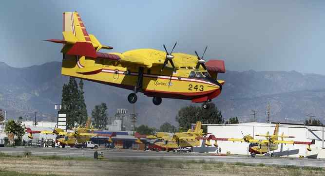
Here is a story from the Los Angeles Daily News with some thoughts on the California wildfires this year and the resources needed to fight them. Give it a read –
KQED Article on Lake Mead and California’s Water

I was recently interviewed for a Water Deeply article on what the falling levels of Lake Mead might mean to California in terms of water. Clearly not a good situation in store for us here in Southern California if present trends continue. Here is the KQED Public Broadcasting Link –
http://ww2.kqed.org/science/2016/06/21/what-lake-meads-record-low-means-for-california/
AAG Presidential Column – The End(s) of Geography?

July 1, 2016 AAG Presidential Column –
The End(s) of Geography?
news.aag.org/2016/07/the-ends-of-geography/
SHARE YOUR THOUGHTS ON TWITTER #PresidentAAG
Serving as your President is a singular honor, but also one that is more than a little daunting. My trepidation arises from three sources. First, with the honor of being elected President comes the responsibility to ably serve the aspirations of a wonderful, but large and highly diverse membership. Second, our past Presidents have set a very high bar of achievements against which new incumbents are sure to be measured. These are big shoes to fill. So, before I move on to my third point, allow me to thank the Members of the AAG for their confidence. I also thank our immediate past Presidents Sarah Bednarz, Mona Domash and Julie Winkler for the inspiration and warm friendship they have provided. In the end, all I can promise is that I will do my very best to serve all our Members and further the legacy of our past Presidents. What I would ask in return is that you share your ideas and experience with me. Be sure to let me know if I miss an important concern or stray off course in addressing such issues. I am very teachable.
Now, allow me to address the third reason why I feel a particularly strong sense of obligation in serving as President of the AAG at this juncture in the history of the Association. This revolves around the value and health of the discipline of Geography, and the very geographical perspectives it engenders. I suppose this existential question might be boiled down to — are we at “the end of geography’? In 1970 Alvin Toffler wrote explicitly about the “Demise of Geography” at the conclusion to Chapter 5 in his book Future Shock. His argument being that geography was losing any importance as people tended to move rapidly from place to place and correlations between societal diversity and place were disappearing. In the four decades since then, the continued ease of transporting people, goods and services over great distance, the explosive rise in information and communication technologies (ITC) and the myriad other phenomena encapsulated in the term globalization have prompted many others to proclaim the demise of geography, or at least wonder about the decreasing importance of space and place as significant forces in driving economic and social differences. The catch phrase ‘geography is dead’ has become a facile cliché in some corners of the ITC and globalization worlds. Works such as The World Is Flat: by Thomas Friedman (2005) and Geography is Dead: How America Lost its Sense of Direction by Brian McCabe (2012) and The End of Geography: The Changing Nature of the International System and the Challenge to International Law (2014) by Sir Daniel Bethlehem provide more nuanced and thought provoking perspectives on certain aspects of this proposition.
In the same vein one might consider the health of Geography as an academic discipline. From the dissolution of the Geography departments at Harvard, Chicago and UC Davis, the last century saw some notable losses to academic geography. In such circumstances a strong professional academic association is invaluable to unite geographers and champion the discipline. Yet we are facing a general climate of flat or declining membership in many such associations. As Denise Lee Yohn wrote recently in the Harvard Business Review (2016), professional association membership is in widespread decline in part because ICT provides online informal social and professional networking opportunities and access to content such as journal articles that negate the necessity of formal association membership. She also notes that Millennials are generally less inclined to value formal networking and organizations than earlier generations.
However, to paraphrase Mark Twain, the reports of the death of geography have been greatly exaggerated. In physical geography and across human geography from economic to cultural perspectives, geographers have demonstrated the power that space and place retain in shaping the world. Indeed, the deeper we look the more we find that many aspects of our own perceptions of the world and resulting actions are formed by our experiences of place and space. We also see how gender, race, economic status and other attributes color how we perceive and respond to differences in space and place. Some discussions and illustrative examples of the importance of geography in the context of globalization may be found in works such as Imagining Globalization by Doreen Massey (1999), The Exaggerated Death of Geography by Kevin Morgan (2004), Geographers and Globalization by Yehua Wei (2006) and Is Geography ‘Dead’ or ‘Destiny’ in a Globalizing World by Anthony Howell (2013). Realization of the critical importance of geography is currently extending well beyond the discipline. This florescence is driven by the scholarly insights provided by geographers and others working from geographical perspectives and by the geographically orientated manifestations of the ITC phenomenon in the form of Geographic Information Sciences and the proliferation of remote sensing, mapping and other spatial based applications that are delivered to us on our computers and smart phones at the flick of a finger.
Academic geography programs still face challenges on some campuses, but we are arguably not in the dire straits one might have expected in the latter decades of the last century. Of note here is the fact that in 2005 Harvard established the Center for Geographic Analysis. Two years later Villanova established a new Department of Geography and the Environment. I recently spoke at the annual seminar series held by the Geography Graduate Group at UC Davis. There I met an exciting group of faculty and graduate students, from diverse academic backgrounds, but all drawn together by shared interest in geography and the perspectives it offers. I also see on my own campus and beyond the reach of geographical perspectives and techniques in the natural sciences, social sciences and humanities. Although admittedly idiosyncratic, from my perspective, interest in geography and geographical perspectives and techniques is very much on the rise in many corners of the academy. Finally, the AAG is certainly not in decline. We now have almost 12,000 members and drew some 9,000 to the recent Annual Meeting in San Francisco. We also see that a large proportion of those members are undergraduate and graduate students representing the critical Millennial generation. About 30% of our membership is drawn from outside the United States and this coupled with the variety of our annual meeting sessions and range of our affinity groups represent a staggering diversity of scholarly perspectives and pursuits.
So, my trepidation in taking up the Presidency is not about the end of geography, but rather how terribly important I feel geography and the AAG is in tackling the critical societal and environmental problems the world faces today. These challenges and the importance of geography in addressing them is driven in part by the very forces of globalization and ICT that others have assumed would lead to the end of geography. The reach of our actions extends globally as too can the actions of actors in the remotest corners of the globe. Actions from faraway can reverberate directly to us wherever we are. Geographical differences in economy, culture, environment, etc., strongly influence these interactions. The more geographers look the more we find a geographically complex world. This is as true for biophysical attributes such as the genetic structure of species or micro-climatic differences as it is for cultural or economic diversity. Therefore, as geographers we know the world is not flat. Rather we recognize that we confront a world that is comprised of a dizzying array of bumps, peaks, hollows and chasms. This diverse human and environmental topography confounds easy answers to critical questions such as how we will feed a world of nine billion?; how will we support an urban population that will comprise 75% of that nine billion?; how will this population impact the environment, including the earth’s climate and how will that environment impact us?; how will all these factors as well as globalization affect human cultures?; how do we study and cope with all these challenges in an increasingly post-factual world in which the capacity and desire to embrace and support reasoned thought and rational actions is often under attack?
Perhaps nothing illustrates the opportunities and challenges we face better than circumstances during my writing of this column. At present I have the benefit of writing on a computer designed in the United States and assembled in China. The computer is networked via fiber optics to the UCLA library system. I am, however, 400 miles away from UCLA at an elevation of just over 8,000 feet in the Sierra Nevada of California. Thanks to a small satellite dish I have been able to watch the BBC News from London while I work. What I have been watching is the vote by the United Kingdom to try and turn back the tide of globalization by exiting the European Union. Almost instantly stock markets around the world, including the Dow, plummeted in response to the potential economic and political implications. A truly globalized experience. However, within the UK the vote was strongly geographically structured with Scotland, Northern Ireland and London being against the exit. Scotland is now considering a second referendum on independence from the rest of the United Kingdom. This could split the nation along clear geographic lines. The strong exit vote in England and Wales was driven by a geographically prescribed sense of British (English largely) identity, a reaction against elites and intellectuals, disdain for increasing EU regulations, including environmental ones and fears about an influx of refugees from civil war, the depravations of ISIS, and lack of food and water in Syria and adjacent refugee camps some 2,500 miles away. None of this is understandable or will be manageable without consideration of geography. It demonstrates the forces of both global connectedness and global geographic diversity operating on multiple scales.
Rather, than asking is this the end of geography, given the plethora of issues facing the world which are intrinsically tied to space and place, the real question for our discipline and our association must be – what are the ends of geography? By this I mean what are the issues that geographers have a special opportunity and responsibility to study? How can we formulate and translate our work to produce and disseminate results that are policy relevant, actionable and accessible to wider audiences both inside and outside academia? How do we recruit and educate new generations of geographers who can take up these responsibilities in the future? How, given the diversity of issues confronting us and the diversity within our discipline, do we generate coherence and build synergies in our departments and in the AAG? These are the questions I hope to address in the remaining 11 Presidential columns. There are no easy answers, but given the challenges we face and the responsibility we have as individual geographers and an association, they are questions we must tackle together. I look forward to a year of sharing my thoughts and benefiting from yours.
— Glen M. MacDonald
Glen MacDonald Quoted on Marketplace Regarding Climate Change and Wild Fires

I was quoted on Marketplace today regarding climate change and wild fires. You can read (and listen) to the story here –
http://www.marketplace.org/2016/05/16/world/fire-season-arrives-could-be-hottest-year-ever
Glen MacDonald to Speak on Drought at UC Irvine
Some Wider Perspectives on the Current California Drought
Presented by Glen M. MacDonald, Ph.D.
John Muir Memorial Chair of Geography, Director of the White Mountain Research Center and Distinguished Professor, UCLA
Date: Tuesday, May 24, 2016
Time: 12:00 – 1:30 p.m. Lecture
Light lunch served at 11:30 a.m.
Location: UCI University Club Library (directions). The event is free and open to the public. Parking is free of charge in the University Club lot.
![]() This event is free and open to the public.
This event is free and open to the public.
Invite your friends on Facebook.
Abstract
The 2011-Present drought has demonstrated California’s vulnerabilities in current water resource infrastructure to cope with long-term aridity such as experienced over the past 5 years. Not only has surface water infrastructure been insufficient, but the limitations of shifting to the consumption of more groundwater, particularly in the Central Valley, has been shown to be a poor strategy going forward into the 21st century. Analysis of instrumental and paleo hydroclimatic records indicates that the precipitation deficit of this drought is not exceptional, but the coupling of the deficit with extraordinarily high temperatures makes this drought exceptional in terms of integrated measures such a Palmer Drought Severity. The southern portion of the state has been particularly impacted. The current drought bears the fingerprint of anthropogenic climate change and is likely a harbinger of California hydroclimatology of the 21st century. Although policy and infrastructure remedies might allow adaptation in terms of consumptive water demands, remote sensing analysis of vegetation response, shows strong decreases in greenness in the southern portions of the state and along the western flanks of the Sierra Nevada. This conveys the reality that although impacts on consumptive use may be mitigated by infrastructure and policy, there is little that can be done to mitigate the long term impacts of a more arid climate on California’s wildland ecosystems.
Some Wider Perspectives on the Current California Drought – Glen M. MacDonald, Ph.D.
Some Wider Perspectives on the Current California Drought featuring Glen M. MacDonald, Ph.D.
John Muir Memorial Chair of Geography, Director of the White Mountain Research Center and Distinguished Professor, UCLA
Date: Tuesday, May 24, 2016
Time: 12:00 p.m. to 1:30 p.m. lecture
Light lunch served at 11:30 a.m.
Location: UCI University Club Library. Event and parking are free. Parking is available in the University Club lot (directions)
Name*
First Name*
Last Name*
Email*
Please identify your relationship with UCI.
Number of tickets needed
(Optional) How did you find out about this event?
e-newsletter From a Friend Social Media University Announcement (zotmail) Today.uci.edu Water UCI website
Other:
Drowning World – Photographic Arts and Climate Change Science at UCLA

Join us at UCLA on Thurs. May 12th for a blending of arts and sciences regarding climate change – Drowning World – Thursday, May 12, 2016 • 1-3 PM • UCLA Glorya Kaufman Hall 200
D r o w n i n g W o r l d
Presentation by Award-Winning Photojournalist Gideon Mendel
Followed by “The Art of Teaching Climate Change” Roundtable
Glen MacDonald, John Muir Memorial Chair and Distinguished Professor of Geography, Ecology and Evolutionary Biology
Katharine Davis Reich, Environmental educator, UCLA Center for Climate Change Solutions
Ramesh Srinivasan, Associate Professor of Information Studies
Anurima Banerji (Co-moderator). Assistant Professor of World Arts and Cultures/Dance
David Gere (Co-moderator), Professor, World Arts and Cultures/Dance; Director of the UCLA Art & Global Health Center
Over the past three years this London-based South African photographer has traveled to flood events in the UK, India, Pakistan, Australia, Thailand, Nigeria, Germany, The Philippines, Brazil, Bangladesh, and the United States. At each location he outfits himself in waders and submerges himself into the floodwaters to connect with victims and document their stories. The result is a startling collection of still and video portraits of flood survivors taken in deep floodwaters, within the remains of their homes, or in submerged landscapes, in the stillness of once lively environments. Keeping their composure, the photographed subjects pause in front of Mendel’s camera, casting an unsettling yet engaging gaze. These images, taken across the world, bear witness to a shared experience that erases geographical and cultural divides. They invite the viewers to reflect on our impact on nature and ultimately, on our own attachment to our homes and personal belongings.
Gideon Mendel is the inaugural winner of the Pollock-Krasner Prize for Creativity, awarded in March 2016. Join us on May 12th to meet the artist and learn more about his creative process and arts activism.
Elected Fellow of the American Academy of Arts and Sciences
I was surprised and elated to receive word that I was elected a Fellow of the American Academy of Arts and Sciences. This organization was established in 1790 and has had a stellar membership ranging from Washington and Franklin and many other majors American figures. It has also included foreign figures such as Gladstone and Churchill. It also has included American and foreign musicians, artists and poets ranging from Tennyson and Kipling to B.B. King! I will travel to Cambridge, Mass in October for the Induction.
The Postclassic Period and the Mayan-Toltec Cities of the Yucatán


During the Postclassic Mayan Period, between approximately 800 and 1000 A.D., the center of Mayan urban development shifted to the northern Yucatán Peninsula of Mexico. Here a series of notable cities such as Uxmal, located in the Puuc Hills near modern-day Mérida, arose. The Yucatán cities of the Postclassic period had large central cores containing huge buildings with elaborate carved or plaster motifs repeated over and over on the masonry blocks. The so called Casa del Gobernador at Uxmal is 8 meters high, 12 meters tall and extends for almost 100 in length. It contains 24 chambers. The facade of the Casa del Gobernador is made up of limestone blocks with over 20,000 decorative elements such as the mask of the rain god Chac. To the east of Uxmal the Post-classic pyramid and its temple at Chichen Itza rises some 30 m above the huge central plaza. It is flanked by various stone buildings and a huge ball court. Cities such as Uxmal and Chichen Itza were smaller than the Classic Period cities such as Tikal and may have had a population of around 30,000.
The monumental architecture of Uxmal, Chichen Itza and nearby Postclassic cities

reflects both the original influence of the classical Mayan world and later elements of the massive stone architecture and symbolic carvings of the Toltec Empire, centered in the Valley of Mexico. The Toltecs arose in Mexico after the collapse of Teotihuacan. These Mexican related symbols include representations of the feathered serpent, Quetzalcoatl, crossed serpents and the Mexican rain god Tlaloc At Chichen Itza the Jaguar Temple contains clear Toltec symbolism including the Toltec Jaguar cult emblem. The precise political relationship between the Toltec Empire and the Yucatán Mayan cities of the Postclassic period is unresolved, but clearly there was a strong Toltec influence on the ruling class and symbolism of the cities.
Why did the Mayan civilization shift its center of gravity to the northern Yucatán during the Post-classic period? What allowed these cities to prosper and grow while the southern lowlands were abandoned? At first glance climate and environment would have seemed to have worked against the northern Yucatán. It has much less precipitation than regions to the south such as Tikal and a drier, less verdant vegetation cover. The limestone bedrock is porous and water quickly disappears from the surface. However, these northern Mayan sites show much evidence of the use of groundwater resources rather than surface reservoirs. These include small water catching subterranean basins and large sink holes – called cenotes. A prominent feature at Chichen Itza is the Cenote Sagrado (sacred cenote). Perhaps the early adaptation of the Maya here to aridity created by the drier conditions of the northern Yucatán coupled with reliance on ground water, rather than evaporation sensitive above ground reservoirs was important in sustaining Mayan urban culture in the Yucatán?

The Maya clearly also turned to religion as a defense against drought. The carvings of the Mayan rain god Chac are ubiquitous in parts of Uxmal and other Yucatán Mayan cities. As already mentioned, there are also representations of the Mexican rain god Tlaloc. The cenote sagrado was a

place of sacrifice – the sacrificial offerings ranged from objects to animals to humans. In fact even after Chichen Itza had been sacked and burned and was no longer a large and important urban center, Maya came to make offerings at the cenote – right up to the time of Spanish contact in the 16th century.
Like the Classical cities to the south – the great Post-classic Mayan cities of the Yucatán also came to an end. The cities appear to have engaged in warfare and petty city states arose and fell, in concert with a decline in architectural and construction quality. Imagery of warfare and human sacrifice abound in the carvings found at many Yucatán Mayan sites. Similar gruesome imagery is associated with the Toltec. The great city of Chichen Itza was destroyed by warfare about 1000 to 800 years ago, at about the same time as the Toltec capital at Tula and the Totec empire collapsed. There is evidence that drought and the displacement of nomadic peoples at the northern edges of the Toltec empire in Mexico may have driven this collapse. With the demise of the Toltec empire in Mexico, the influence of the Toltecs receded from the Yucatán. From the ashes of the Toltec legacy would arise the Aztec empire, but it did not reach into the Yucatán at the time of Spanish contact. Aridity, drought, soil depletion may all have affected the Postclassic Maya, but human conflict appears to have been the critical element at play in the Yucatán during the Postclassical Period.

Triumph and Tragedy During the Mayan Classic Period


Driving northeast from the city of Flores in Guatemala it is hard to believe that dense and seemingly uninhabited rainforest once supported a largely agricultural landscape and innumerable human habitations. It is harder yet to imagine that some 1200 years ago the ruins of Tikal, empty and isolated today in the midst of a deep green forest, was once a thriving city of some 300,000 to 500,000 Mayans. In its day it rivaled in size and splendor the contemporary cities of Europe. I traveled here as part of my Guggenheim research in early 2009.
When Hernán Cortés first arrived on the shores of Lake Flores in 1540 he found a small Mayan Kingdom situated there. In fact, it was here in Guatemala that the last independent Mayan state made its stand against the Spanish in 1697 before at last being absorbed by the Hispanic kingdom of the New World. However, the Maya the Spanish encountered at Flores were not directly from Tikal, but were Itzan refugees from the Maya-Toltec cities of the southern Yucatan Peninsula. They had arrived at Flores only some three centuries earlier themselves. When the Spanish arrived at Flores the great city of Tikal had already lain abandoned for hundreds of years and was likely all but subsumed under a blanket to uninhabited rainforest that extended for hundreds of square kilometers around it. The history of the Maya and their great Classical urban centers, such as Tikal, which flourished from 250 A.D. to 800 A.D. or their later impressive Postclassical cities of the Yucatan remain one of the great objects of interest to archaeologists and climate change scientists alike.

Between 400 B.C. and 250 A.D. the Pre-Classic Mayan civilization arose in Southern Mexico and nearby parts of Belize, Guatemala, El Salvador and Honduras. Large stone buildings took form in the center of emerging cities. During the Classic Period between 250 and 800 A.D. the Maya used thousands of stone blocks, usually cut from soft limestone and often covered with plaster and various decorative elements, to create huge city centers with expansive plazas, pyramidal temples and other ceremonial structures, palaces and large ball courts. As the Mayan cities grew in importance the monumental architecture of temples, palaces and administrative complexes reached considerable proportions. For example, the urban core and residential areas of Tikal likely covered some 60 square kilometers and included pyramids that exceed 50 m in height. There was also a large central acropolis that covered some 8000 square meters and many other great and impressive structures. There is evidence of some trade linkages with the great empire of the Valley of Mexico to the north – Teotihuacan -. The Maya also developed a written language, recording events in glyphs written in codices and carved on stone steles placed in city centers. The monumental architecture at Tikal and other Classical Mayan sites is massive, angular and exceptionally well proportioned – giving it a very contemporary or even futuristic air. For example, Tikal served as the background ruins used as a rebel base in the Star Wars movie.
Although the area of Guatemala where Tikal is found, and the other Mayan southern lowlands sites that supported the great cities of the Classic Period are relatively moist, the region can experience prolonged droughts. In fact according to UN reports during 2009 the country is experiencing its worst drought in 30 years with some 2.5 million Guatemalans being affected. Hundreds of thousands are facing severe hunger. Then, as now. It is likely that drought was a potential deadly menace. The urban infrastructure at Tikal includes extensive canal systems and surface water reservoirs – some of which hold water to this day. The Maya here appear to have depended upon the capture of surface water to hold them through dry periods.

The Classic Maya period and the great southern cities appear to have ended in a catastrophic manner. There is evidence of warfare, burning and hasty construction of defensive walls in some city centers. In some cases there is evidence of the massacre of the rulers. Unfortunately, the written history of the Maya provide no insight into what happened. By the end of the classic period the Maya had ceased to erect stone stele with inscriptions. Most of the codices found by the Spanish were destroyed by people such as Bishop Diego de Landa in the 1500 and 1600’s because he thought them satanic. Only four survive today. This must surely be one of the greatest travesties to have occurred in recent times in terms of destroying the history of an entire people.
Studies of past climate and environmental change, often based on sediment records from lakes or the ocean, suggest that the close of the Classic

Mayan period coincided with a period of extended drought in Central America and portions of northeastern South America. There is also evidence of pronounced soil erosion at this time. Could drought have caused the collapse of the Classic Mayan cities in the southern lowlands, or was it simply one component that included societal breakdown due to over population, soil depletion, inter-urban warfare, and an unsustainable social structure with a lavish lifestyle for the rulers and priests and brutal conditions for most others? Finally, the collapse of the Classical Mayan civilization appears to coincide with the collapse of the great empire Teotihuacan to the north. Perhaps the severing of trade and military-political linkages may have played a role in the decline of the Classical Maya. It is hard to point to any one of these factor after 1200 years. It is also hard to decipher why at no time after 800 A.D. did the Mayan people reoccupy the former fields or city centers at places like Tikal? What kept them away for over a thousand years and allowed the rainforest to reclaim the fields, buildings and silent plazas of the once great cities?
Egypt and the Nile 5 – Climate Change and an Uncertain Future

With drought in Ethiopia and East Africa comes famine in Egypt. Rainfall is sparse and cannot replace the water of river. The failure of the Nile can have profound impacts on a land with so many people dependent on one source of water. The Old Kingdom of Egypt ended at around 2200 BC – a period which experienced widespread drought in many parts of the Bronze Age world (See Syria Blog Entries). There may have been other issues promoting instability at this time, but there is evidence people lost faith in the divine abilities of the Pharaoh. The crown of Upper and Lower Egypt no longer represented a strong and unifying government and the country split into smaller satraps – this was the time of the First Intermediate Period. A time of extinguished central government and uncertainty. both contemporary carvings of famine and Ptolomaic era carvings provide evidence of severe drought and famine in Old Kingdom Egypt well before the collapse of the last dynasty.

What does the future hold for Egypt in terms of climate change? It is difficult to predict at present in some ways. Climate models suggest that with increasing greenhouse gasses the Northern Africa and the Near East will become drier. However, for Egypt the critical question is what will happen with the flow of the Nile and this depends on conditions in Ethiopia and East Africa – here it is not as clear what will happen with increasing greenhouse gasses. It is possible that conditions will be become so dry that not even the High Dam and Lake Nasser will provide complete insulation against drought and famine.
In addition to decreased flow of the Nile, drying in the desert will drive nomadic herders off the land and put additional pressure on the Nile Valley. Finally, drought can destabilize adjacent countries such as Sudan, exacerbate social tensions and cause carnage. The bloody and bleak situation in Dafur could be a taste of things to come.
Although what will happen to the climate and hydrology of the upper reaches of the Nile as greenhouse gasses increase remain a question – the impact of the inexorable rise of sea level if climate continues to warm is more certain. Even a modest rise of sea level would produce a loss of a significant proportion of this productive farm land – not to mention the inundation of coastal ports such as Alexandria. A rich and technologically sophisticated nation such as the Netherlands, might be able to produce extensive dike systems to protect low lying lands, however, Egypt with a small average per-capita annual income and much less in terms of financial resources would be helpless to confront such a challenge alone. For a nation with a growing and still relatively poor population it seems all too possible that climate change and rising sea levels could produce profound social disruption and unrest – with potential repercussions far beyond the rim of the Nile Valley. Much to ponder as I returned to California in late November at the end of the 2008 portion of my Guggenheim Fellowship.
